SNOWFLAKE PATHWAYS
A HISTORY IN PICTURES
![]()
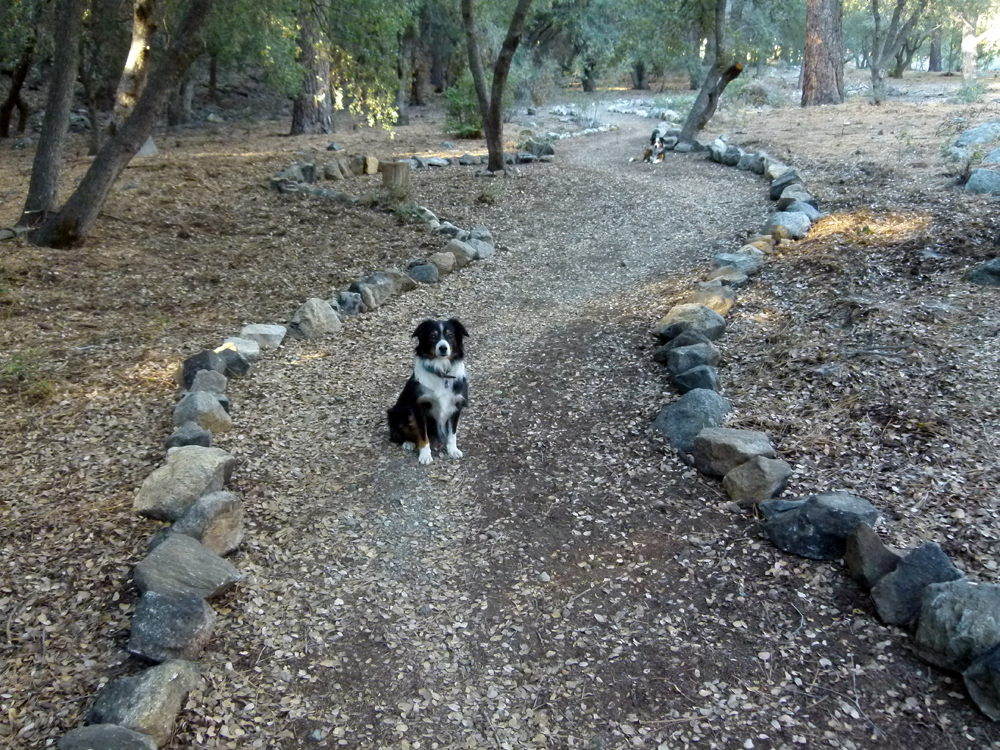
2015
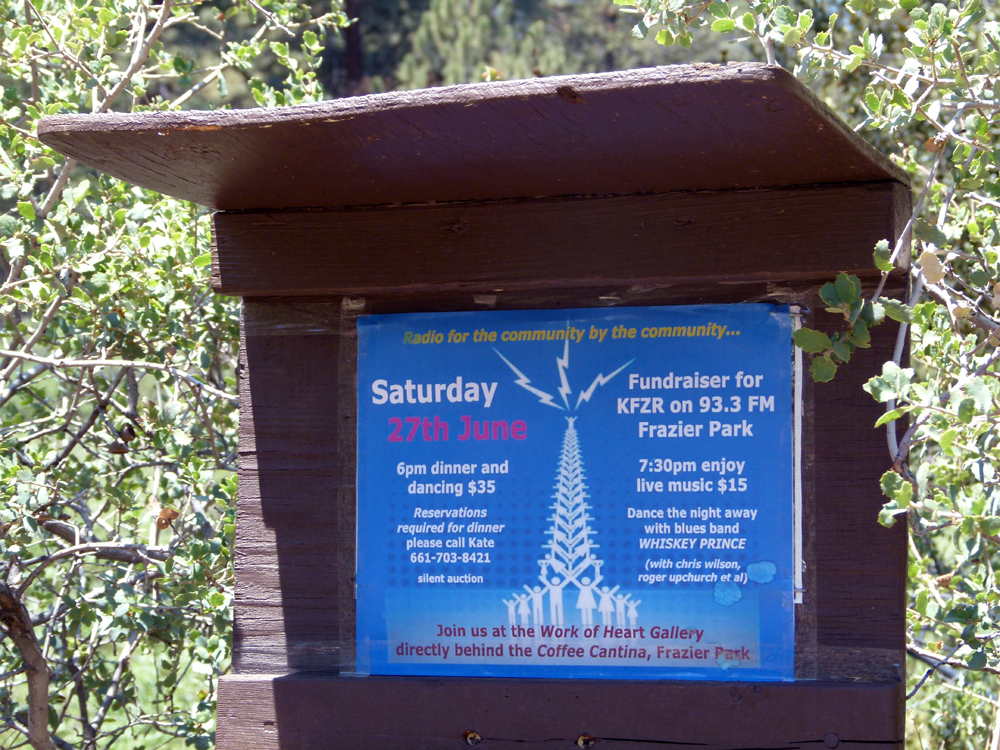
(1) ^ ^ ^ In support of this local initiative to build a community FM radio station on the mountain.
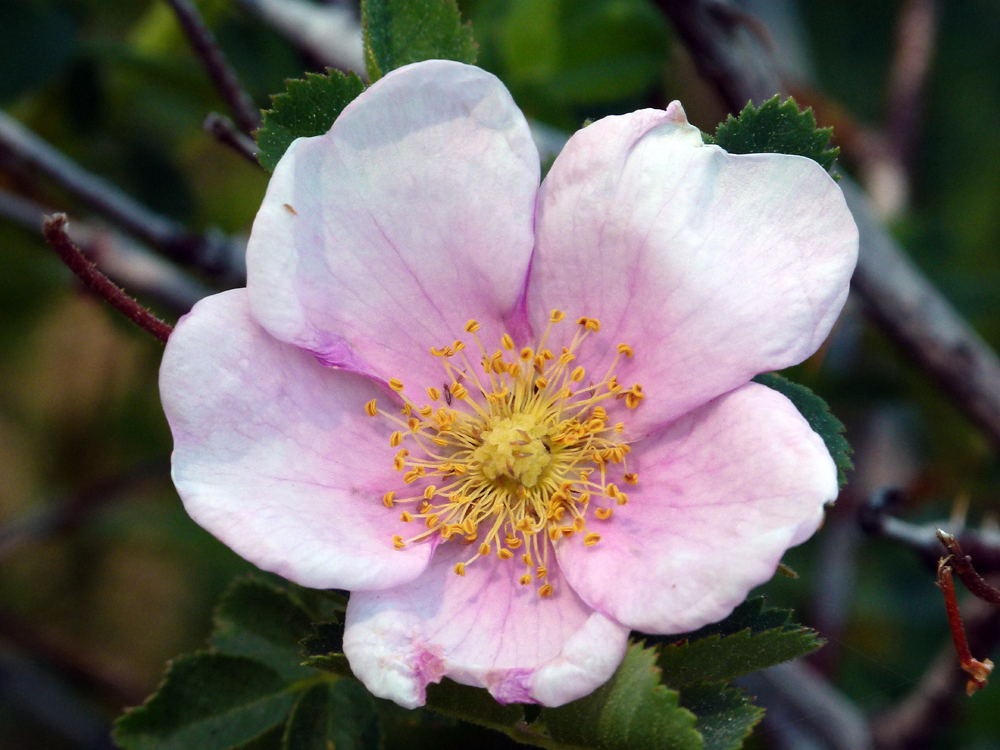
(2) ^ ^ ^ The wetlands area features a vast field of wild roses (Rosa Californica / California Wild Rose) that bloom as regular as clockwork each year.
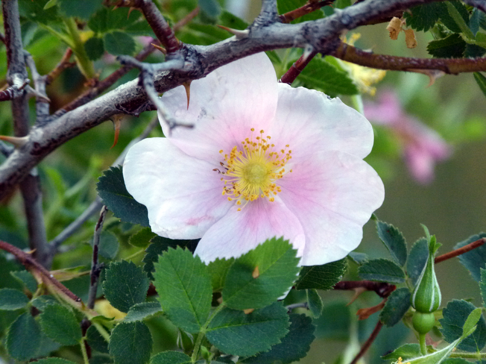
(3) ^ ^ ^ The scent is truly exquisite (strongest immediately after blooming).
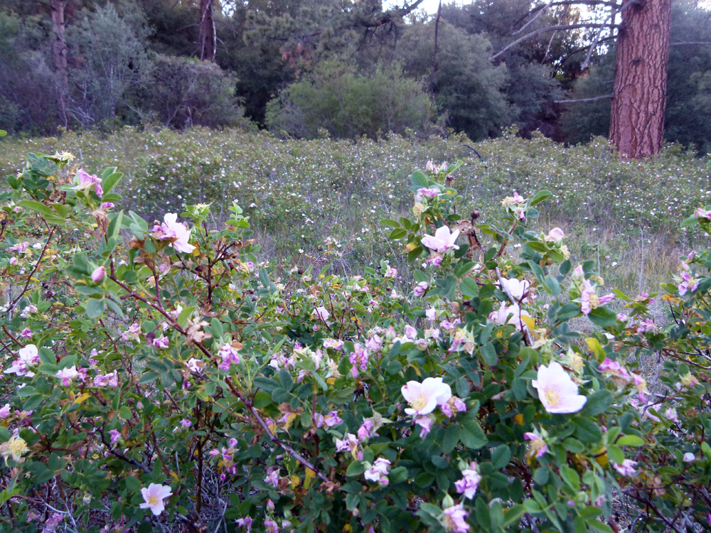
(4) ^ ^ ^ The first flowers appeared on the western extremity of the field (background in this photo) during the first week of June. As if in rolling fashion, the whole field started to bloom from west to east over the course of about 10 days until the whole area was ablaze with these pretty little flowers. The flowers typically remain well into the month of July and eventually turn into rose hips.
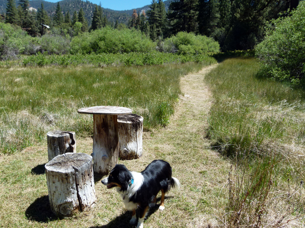
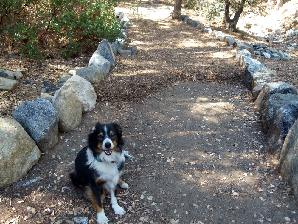
(5) ^ ^ ^ Deanna has taken on the task of maintaining the grass walking trails in the wetlands area over the years. These pathways need regular trimming at least 4 or 5 times each year, especially in the fast-growing season in the spring and summer. She's been doing this routinely for over a decade now since the grass pathways were first developed in 2003. Her efforts help protect this ecosystem by encouraging all foot traffic to follow the pathways rather than having people stomping around the area haphazardly (as used to be the case prior to 2003). The wetlands trail was the original (or first) trail crossing the greenbelt from east to west providing a short cut to the PMC Village Center on foot. It is a serene, beautiful area. Enjoy!
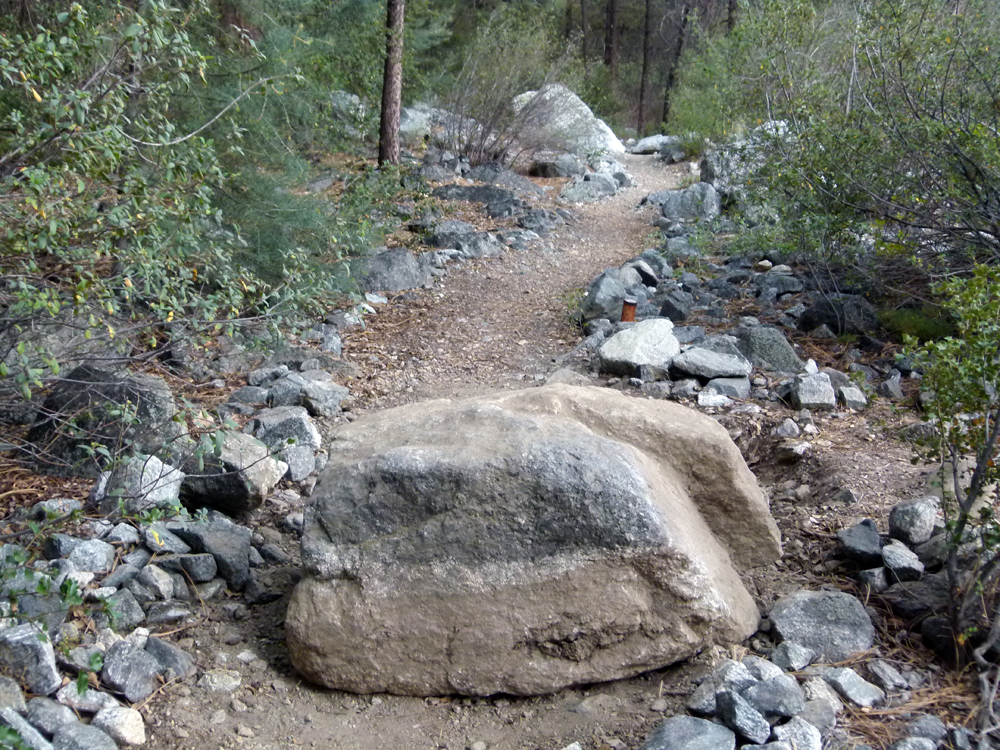
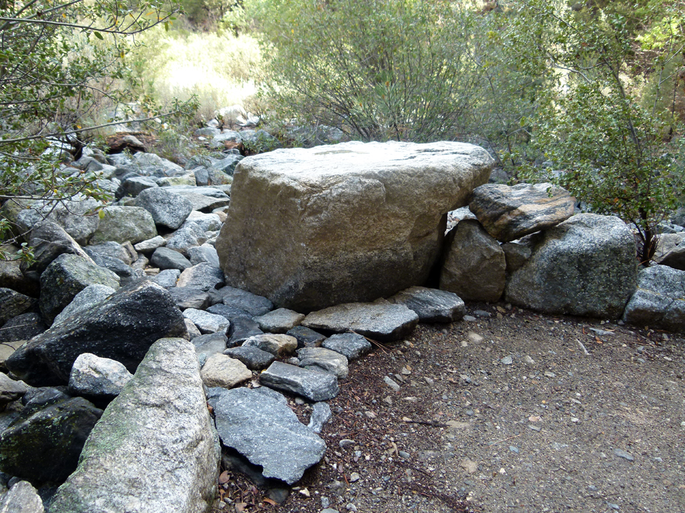
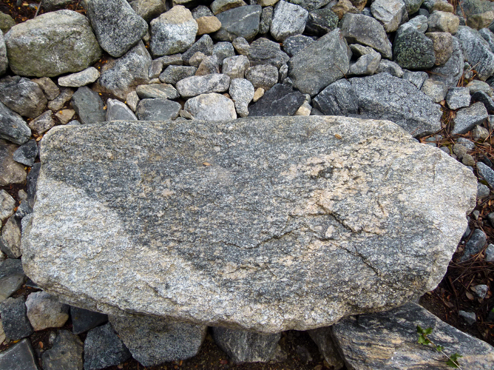
(6) ^ ^ ^ This boulder was protruding above the ground across the width of the trail leading to the upper greenbelt. The exposed part of the boulder is the cleaner, gray-coloured section seen in the photo. This obstacle meant people had to either step over it, or step around it, as they passed by. I was concerned someone might accidentally trip over it, especially in poor light, so I decided to remove the obstacle in the interest of public safety. This meant digging up the boulder in order to move it. The boulder was effectively "cemented" in the ground over the eons and was immovable with pry bars. So the technique for removal was to start by digging around the boulder to expose as much of it as possible. Once I got it loose and moving with pry bars, the next step was to get it out of the deep hole in which it was lying. That was the hard part since the boulder probably weights half a ton and you can't lift that sort of weight vertically without machinery. The "trick" I used was to rock the boulder back and forth and slowly fill the hole underneath the boulder with dirt and small rocks effectively floating the boulder to the surface (so to speak) in order to get it close to the ground level. Then you can slide it out of the hole with pry bars and fulcrums an inch or two at a time.
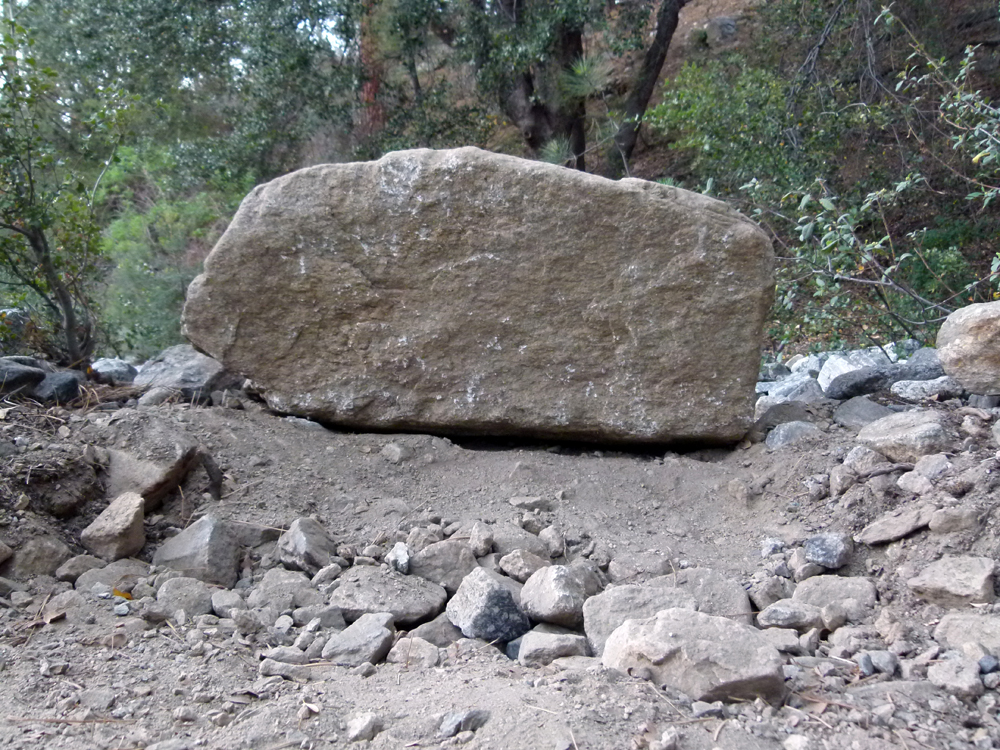
(7) ^ ^ ^ The boulder has an almost perfectly flat side so it will make a nice seat beside the trail. This will allow those strolling by to sit for a moment and enjoy the spectacular views of San Emigdio Mountain to the north west. This view is especially beautiful in the early morning or in the late afternoon light around sunset.
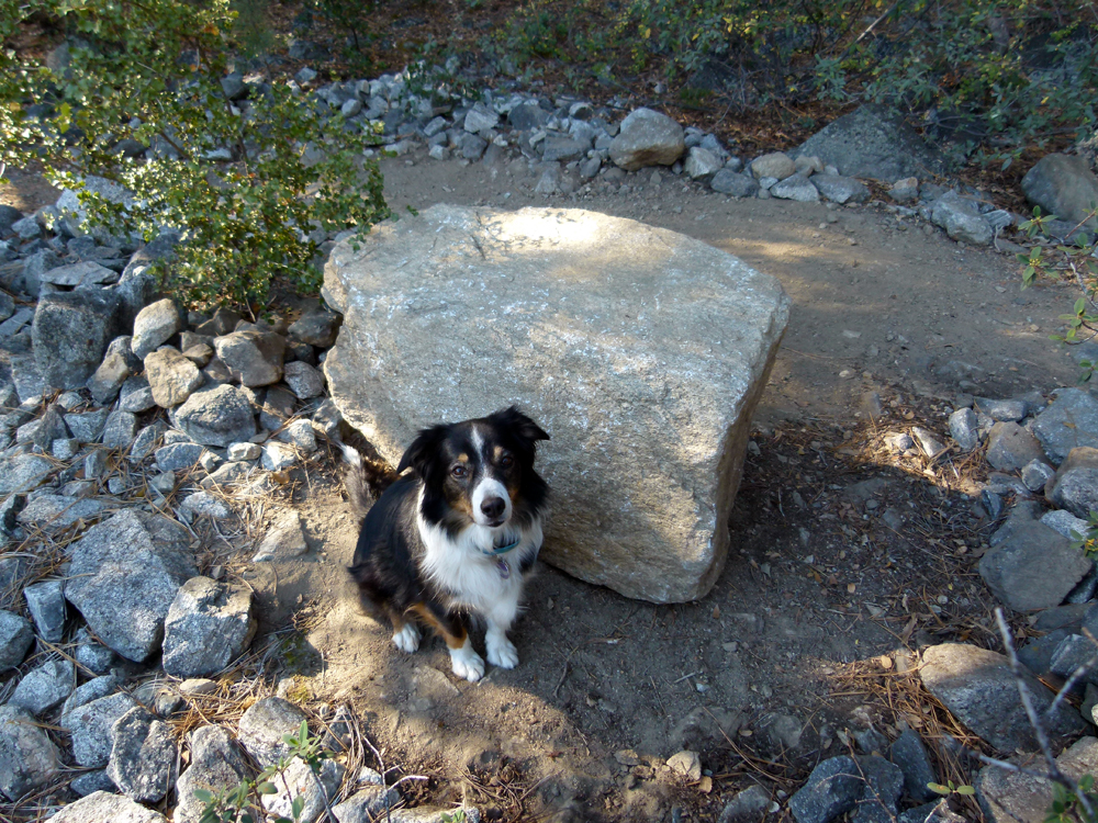
(8) ^ ^ ^ "Walking" the boulder off the trail inch by inch. Its final resting place will be where Paris is sitting.
(9) ^ ^ ^ The new seat in its final position.
(10) ^ ^ ^ A comfortable seat ready for those wanting to take a break and appreciate the view.
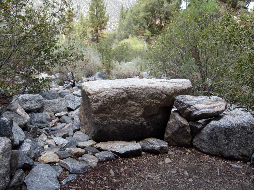
(11) ^ ^ ^ Enjoy.
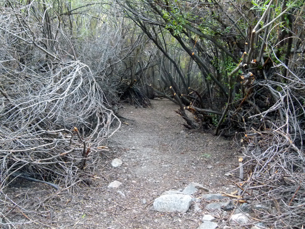
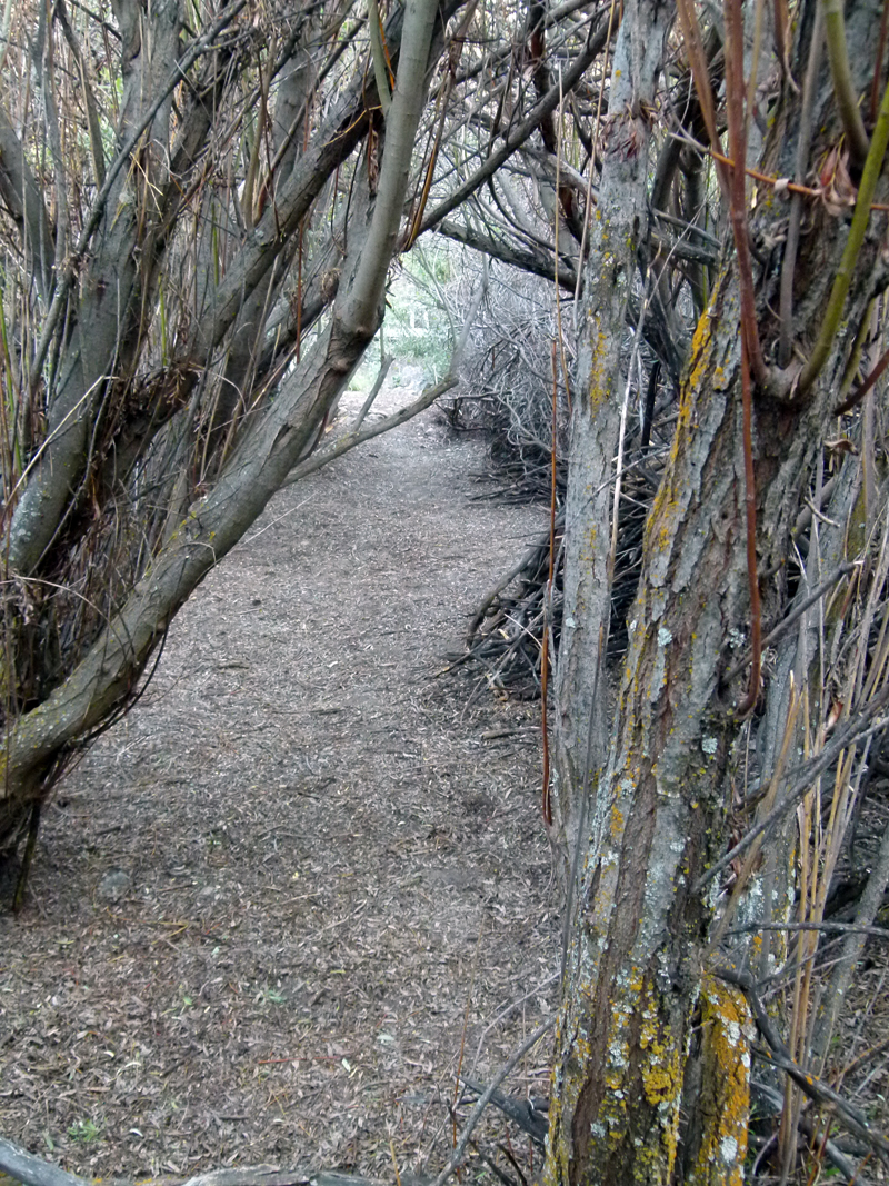
(12) ^ ^ ^ A different concept for trail building, effectively a "tunnel" trail through this thicket of trees. The trees are a type of willow tree - one of over 500 known species. I believe our particular variety is called Lemmon's Willow (Salix lemmonii).
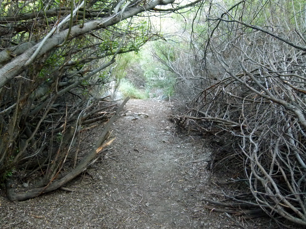
(13) ^ ^ ^ This trail provides a covered route from the Wedding Bridge (just visible in the background) to the edge of the wetlands area where it joins the mown, grass pathways in that area.
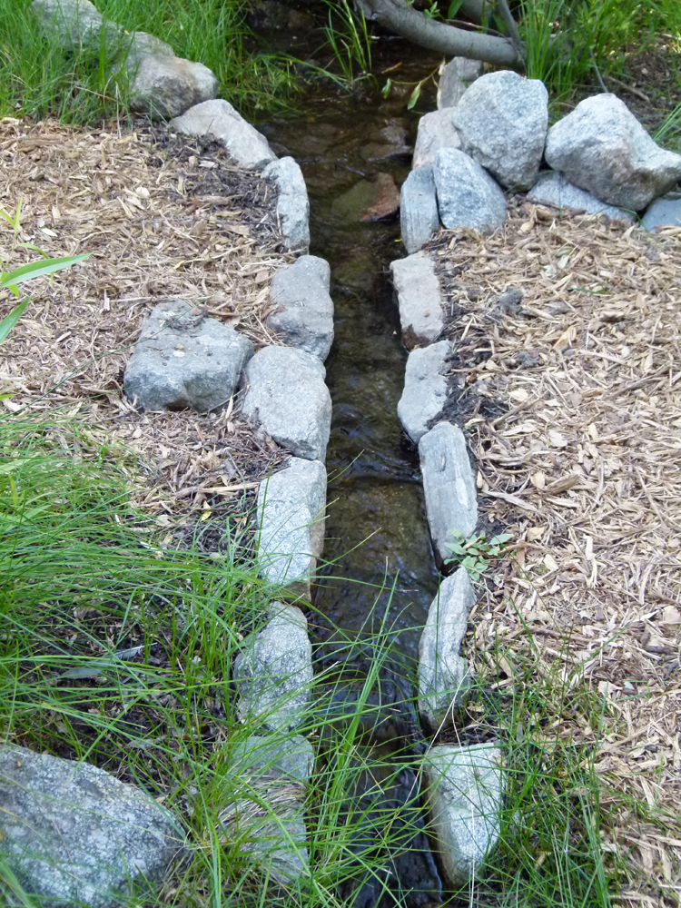
(14) ^ ^ ^ The tunnel trail joins the wetlands trail right next to this water flume (currently not flowing).
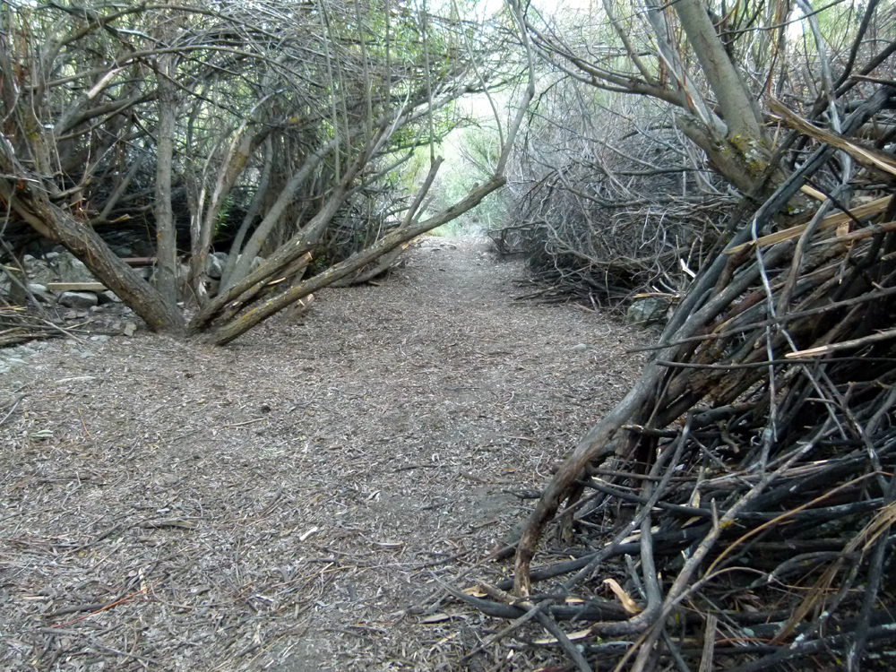
(15) ^ ^ ^ The project to tunnel through this dense thicket of willow trees started over 11 years ago. Wet snowfalls in the last decade have collapsed the canopy overhead blocking the route, so there have been several clearing operations to keep it open and accessible. Punching through the final 20 feet or so (as seen here) to complete the route all the way to the Wedding Bridge was finally achieved in early June 2015.
(16) ^ ^ ^ This one is especially for the kids (a secret, hidden trail) although all the adults I've taken through there seem to enjoy it just as much as any youngster. We are kids at heart, I guess?
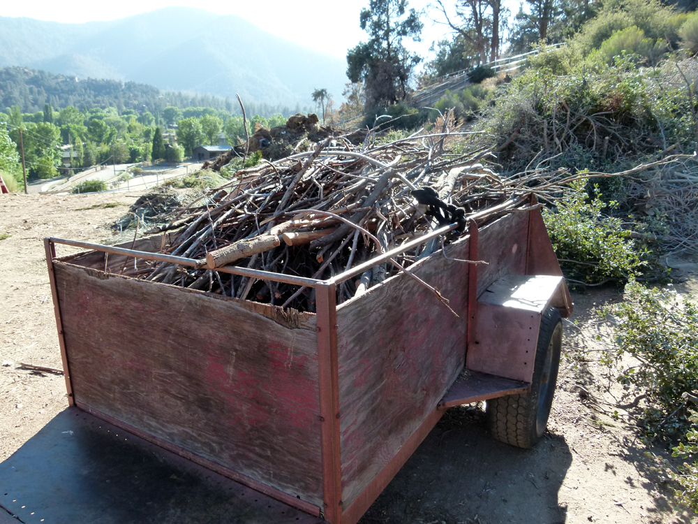
(17) ^ ^ ^ All the branches from a clearing operation like this are taken to the organic waste site for chipping and re-use.
(18) ^ ^ ^ Upgrading the pathway that heads up the wash (south) towards water tank #C.
(19) ^ ^ ^ Converting a rough trail into a graded pathway.
(20) ^ ^ ^ Starting to lay the base foundation for this new pathway. Many more wheel barrow loads of rocks and fill dirt to come.
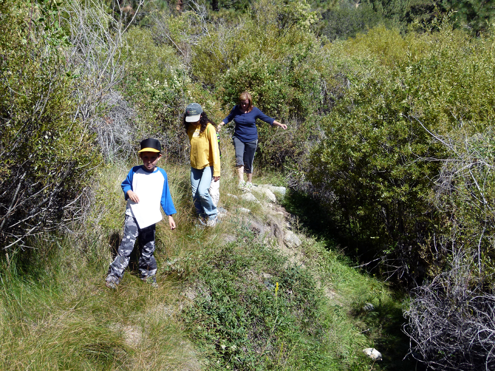
(21) ^ ^ ^ About half the length of this new section of pathway finished with wood chips (aka slash).
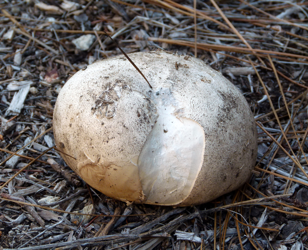
(22) ^ ^ ^ During the early part of August, many very different varieties of fungi appeared in the green belt, large and small.
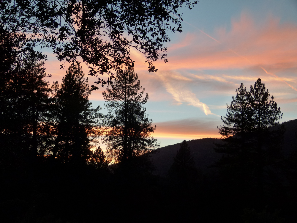
(23) ^ ^ ^ A beautiful sunset on 13th August 2015 as seen from the green belt.
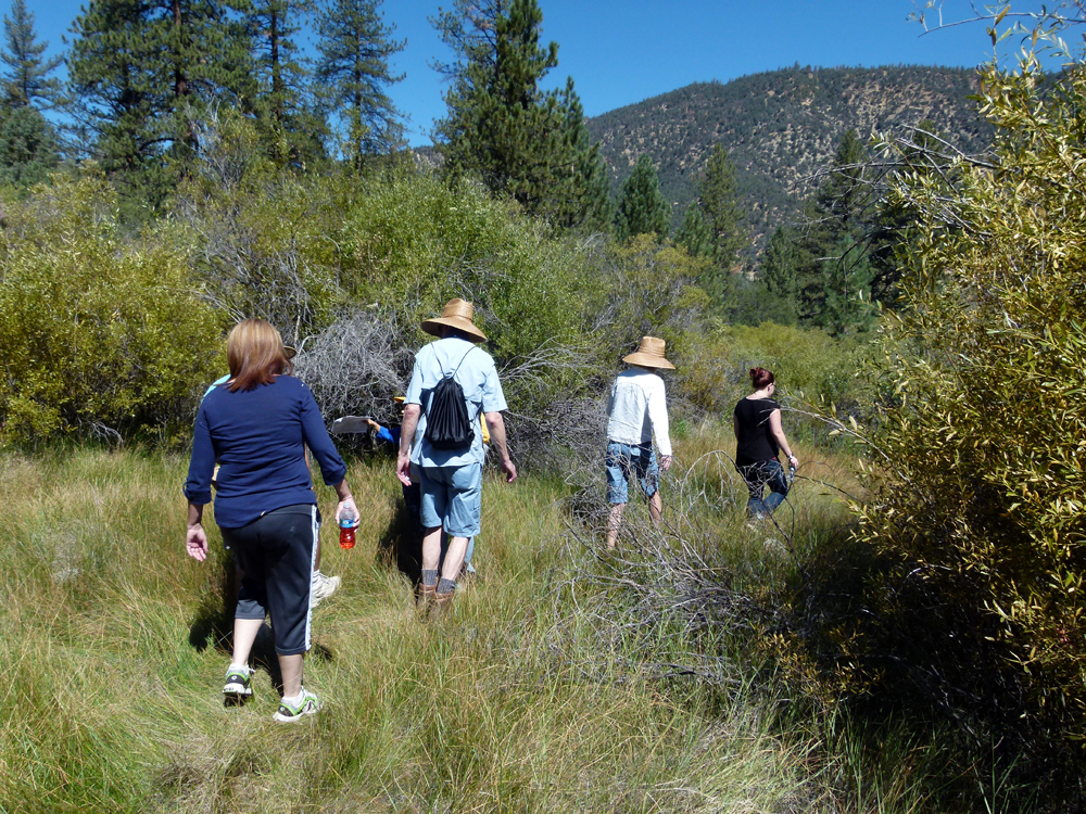
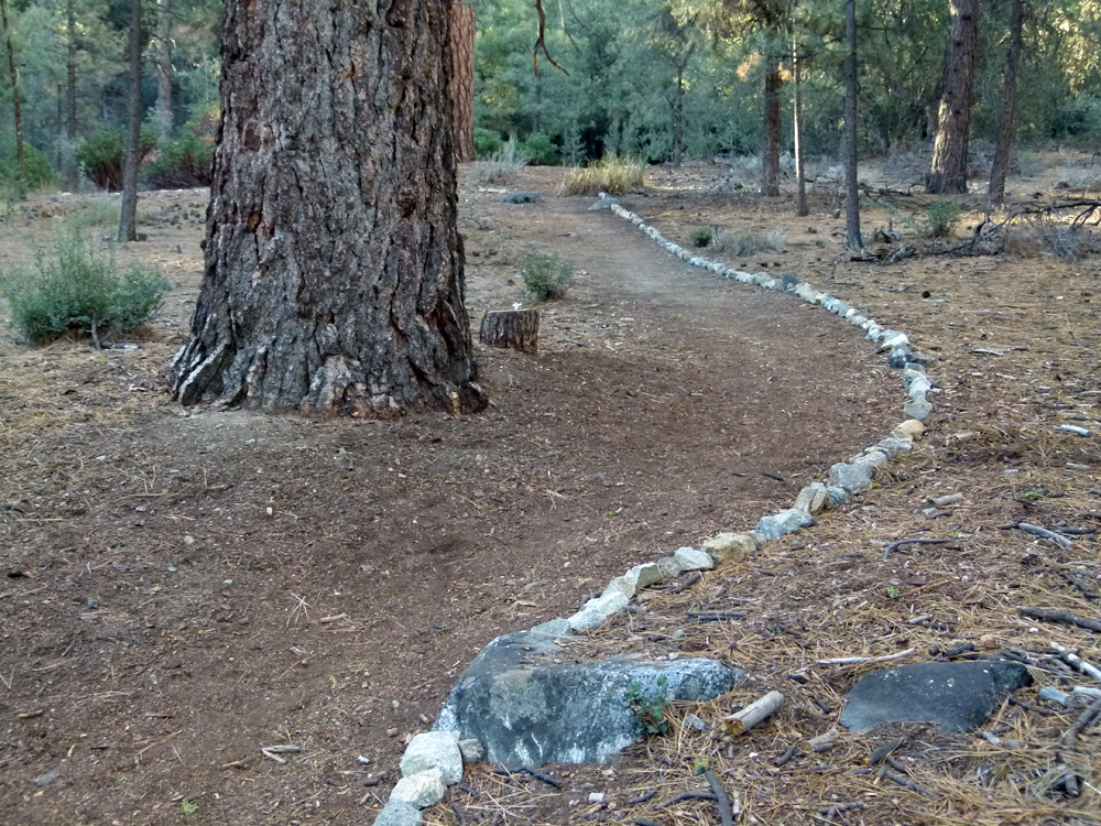
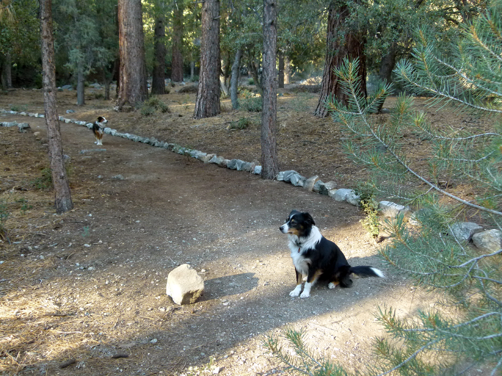
(24) ^ ^ ^ A community stroll along the Snowflake pathways and trails on Saturday morning 15th August 2015 organised by Mandi Lyons, the Recreation and Facilities Supervisor for the Pine Mountain Club Property Owners Association.
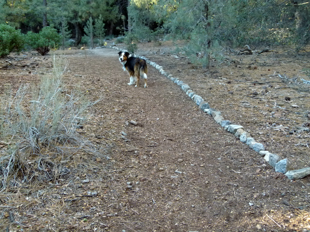
(25) ^ ^ ^ Exploring Woodland Creek just upstream of the "capture pond" that diverts the water to the golf course. The creek has carved a deep "canyon" through which it flows in this section.
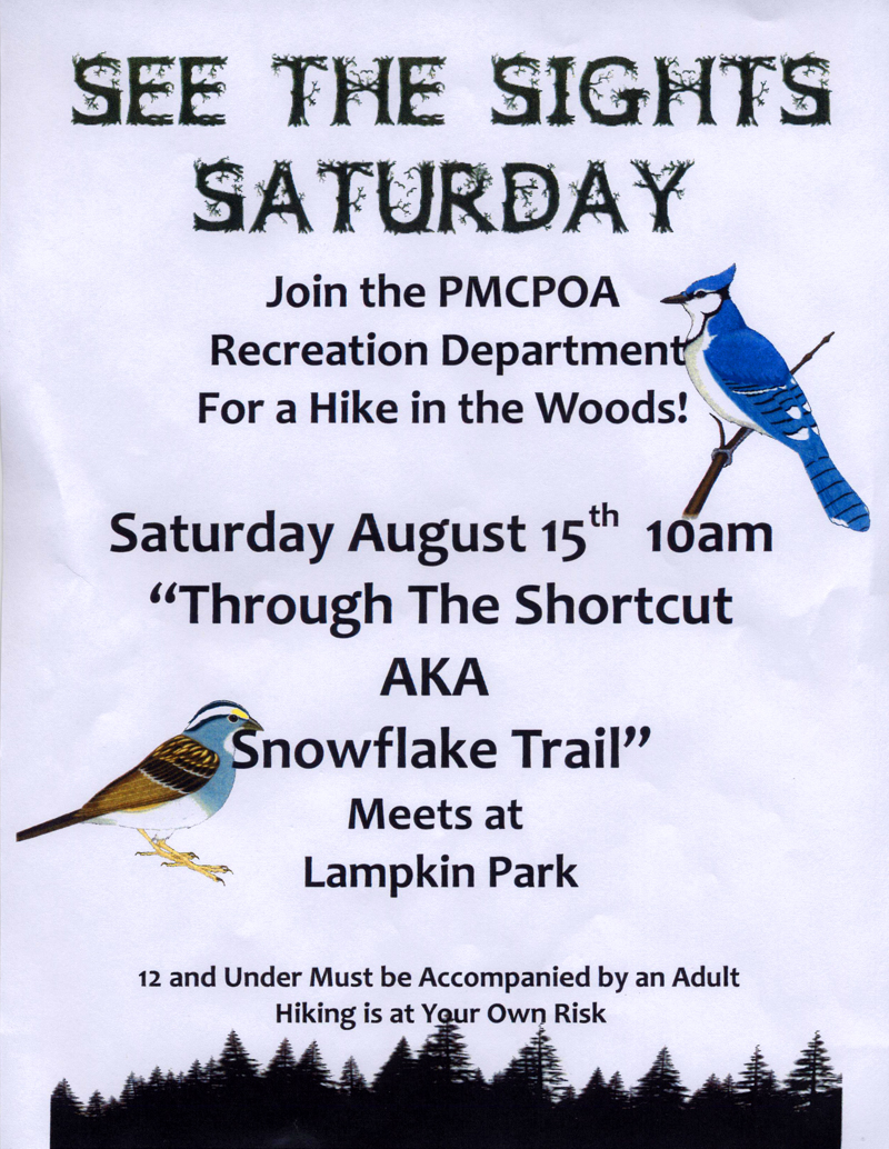
(26) ^ ^ ^ Flyer advertising the above outing.
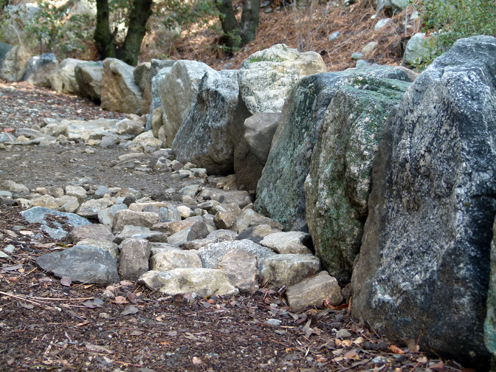
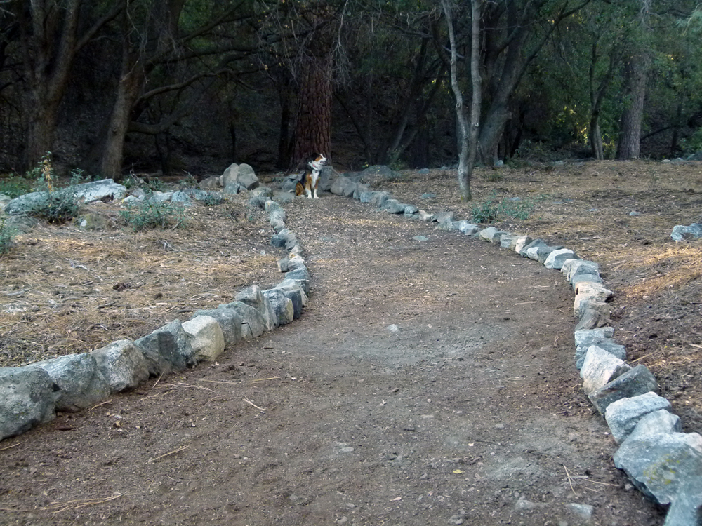
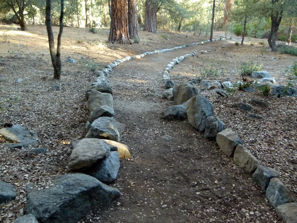
(27) ^ ^ ^ Extending the trail into the Upper Bernina Nook with help from the community (I'm told an elderly couple collected and laid the stones you see in the foreground).
(28) ^ ^ ^ The adjoining section.
(29) ^ ^ ^ The next adjoining section.
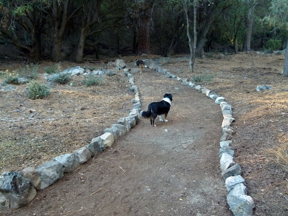
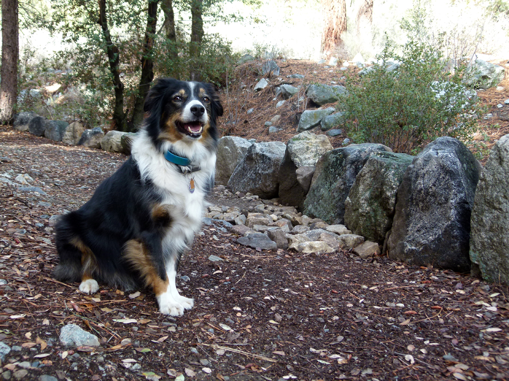
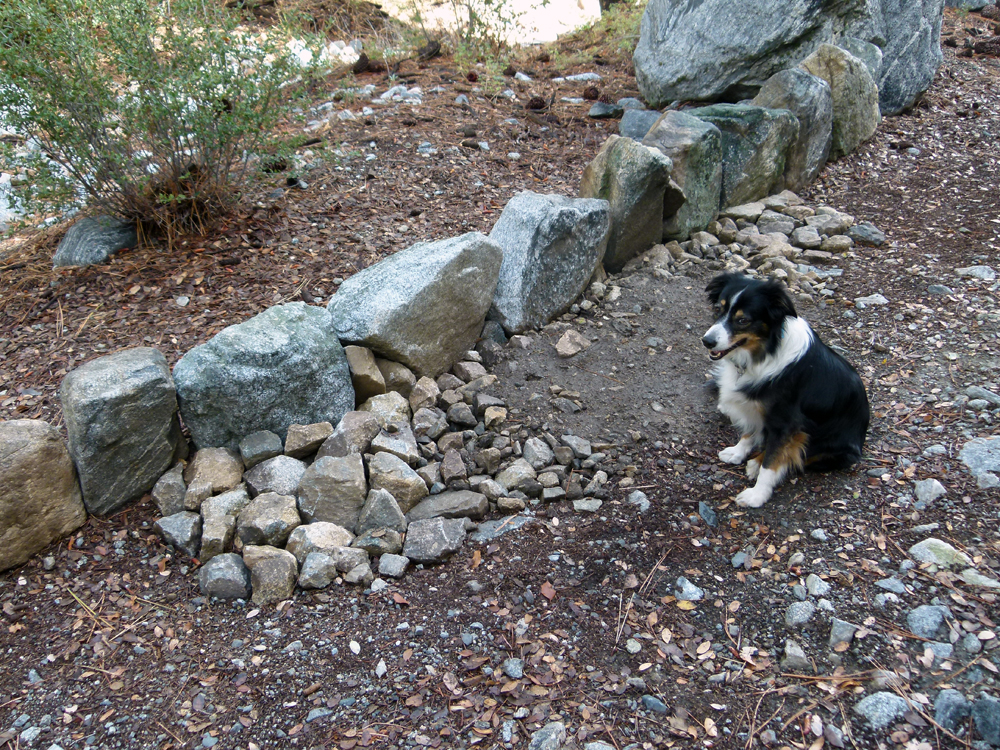
(30) ^ ^ ^ The next adjoining section.
(31) ^ ^ ^ The same section - different angle.
(32) ^ ^ ^ Looking back the other way.
(33) ^ ^ ^ With deep appreciation to Jacqueline and Brian who built this next section of the trail which meanders up the green belt (heading south) and eventually joins the maintenance road half way between water tanks #C and #D. A marathon effort. They did this work a little bit at a time over a period of a couple of years (so far). As the area is developed, more and more people are starting to use this very pleasant route. They are continuing to expand their charming network of trails even further....
![]()